
Browse Bloomfield Streets by Address
A useful Bloomfield street directory starts with an address that can be tested against more than one record set. The first question is usually who the town associates with the parcel, not who happens to answer a door today. The assessor card supplies the current owner, mailing address, situs or location, unique identifier, map and lot references, parcel ID, acreage, land use, zoning, and book and page clues. GIS then helps place that parcel beside the rest of the road. Deeds, voter information, and older listings add separate kinds of evidence.
- Run the house number and street through the Bloomfield MapXpress property search. Save the owner, situs, mailing address, Unique ID, map and lot, PID, and book and page.
- Open the parcel in the GIS viewer. Turn on Street Labels and parcel information, then inspect adjacent parcels with the map and print tools.
- Use the official Bloomfield voting lookup with a person’s name and date information when the question is registration or polling context. Treat a protected or missing result as a limit, not a negative identity finding.
- Search the current owner as grantee in the land index. Read the seller, legal description, recording date, book and page, and instrument type before moving to an earlier owner.
- For an older household, compare Hartford-area telephone books, library holdings, census schedules, newspapers, and local house histories. Use the historical street name when the modern address does not match.
The chain is strongest when each step preserves the same parcel identifier. A name alone can point to a different person, and a mailing address can belong to an owner who is not at the mapped property. Street-level research is therefore a process of matching roles, dates, and legal descriptions.
Bloomfield Street Directory Records
Connecticut counties are geographic for this purpose. Bloomfield has no Hartford County recorder for ordinary land recording. The Bloomfield Town Clerk is the local custodian for land records, vital records, trade names, election records, and other town records. That structure makes it important to use the right counter when a web result ends. The following address-keyed sources work together, but no row is a complete list of people at a street address.
| Record set | Keeper | What it can show | Access route |
|---|---|---|---|
| Assessor card and Grand List | Bloomfield Assessor | Owner, mailing address, situs, parcel IDs, acreage, class, zoning, and building facts | Free MapXpress search and card; assessor office at 860-769-3530 |
| GIS parcel map | Engineering and GIS | Parcel shapes, adjacent IDs, Street Labels, zoning, flood, wetland, sales-year, aerial, and infrastructure layers | Free interactive viewer; lines are approximate |
| Deeds, mortgages, liens, and maps | Bloomfield Town Clerk | Grantor, grantee, instrument type, recording date, book and page, legal description, and image when available | Free index and watermarked view; paid print or download |
| Voter registration record | Bloomfield Registrar and Connecticut SOTS | Public name, residence information, party, participation history, and birth year in the released file | Individual lookup or written statewide-file request; privacy rules apply |
| Building and permit file | Building and Land Use | Applicant, owner, address, permit type, inspection, and status when released | Current application route, counter, or targeted FOI request; public address index not located |
| Police location record | Bloomfield Police Records Unit | Releasable report or log tied to a location, record type, and time period | Written request to 785 Park Avenue or 860-242-5501; exemptions and redactions apply |
The Bloomfield land-record instructions point back to the Town Clerk rather than a county office. The Assessor page and its assessment-process explanation clarify the current card and Grand List role. A street search can move from card to map, from map to parcel ID, and from parcel ID to a deed. For current civic questions, the registrar is the human check. For older names, the library and historical society are better bridges than a current tax page.
Bloomfield Street Search Fields
The main MapXpress property screen is narrow but useful. It does not present a visible ZIP field. Search by owner or business name, by house number with the street selector, or by Unique Id. The street selector loads the town’s street list dynamically, so a searcher should keep the spelling shown by the portal and also note any historical variant found in a deed or local history source.
| Field | Type | Required | Options or format notes |
|---|---|---|---|
| Property Search Name | Text | No | Owner or business name; the inspected example uses Smith. |
| House No | Text | No | House number used with the Street selector. |
| Street | Selector | No | Bloomfield street list; the complete options load dynamically. |
| Unique Id | Text | No | Parcel or record identifier; the inspected example uses 7764. |
| GO or search control | Button | Action | Runs the query and opens the property result or parcel card. |
There is no visible ZIP filter on this search screen, so a ZIP-wide Bloomfield street directory should not be promised from MapXpress. Use a specific house and street, then verify postal information through USPS when the postal boundary itself matters. The card may also show a mailing address that differs from the situs address. That difference is a research clue, not proof of who occupies the property.
Bloomfield GIS Layers for Streets
The interactive GIS viewer is the best way to browse a road parcel by parcel after a search has produced a Unique ID. Use Street Labels and parcel information first. Add zoning, flood, wetland, sales-year, aerial, or infrastructure layers only when they answer the question. Multi Select can gather a visual group, and polygon or buffer tools can describe an area around an address, but those tools do not create a legal boundary or a published household list.
The Bloomfield interactive MapXpress viewer shows how parcel selection, layer controls, measuring, buffering, and printing fit together.
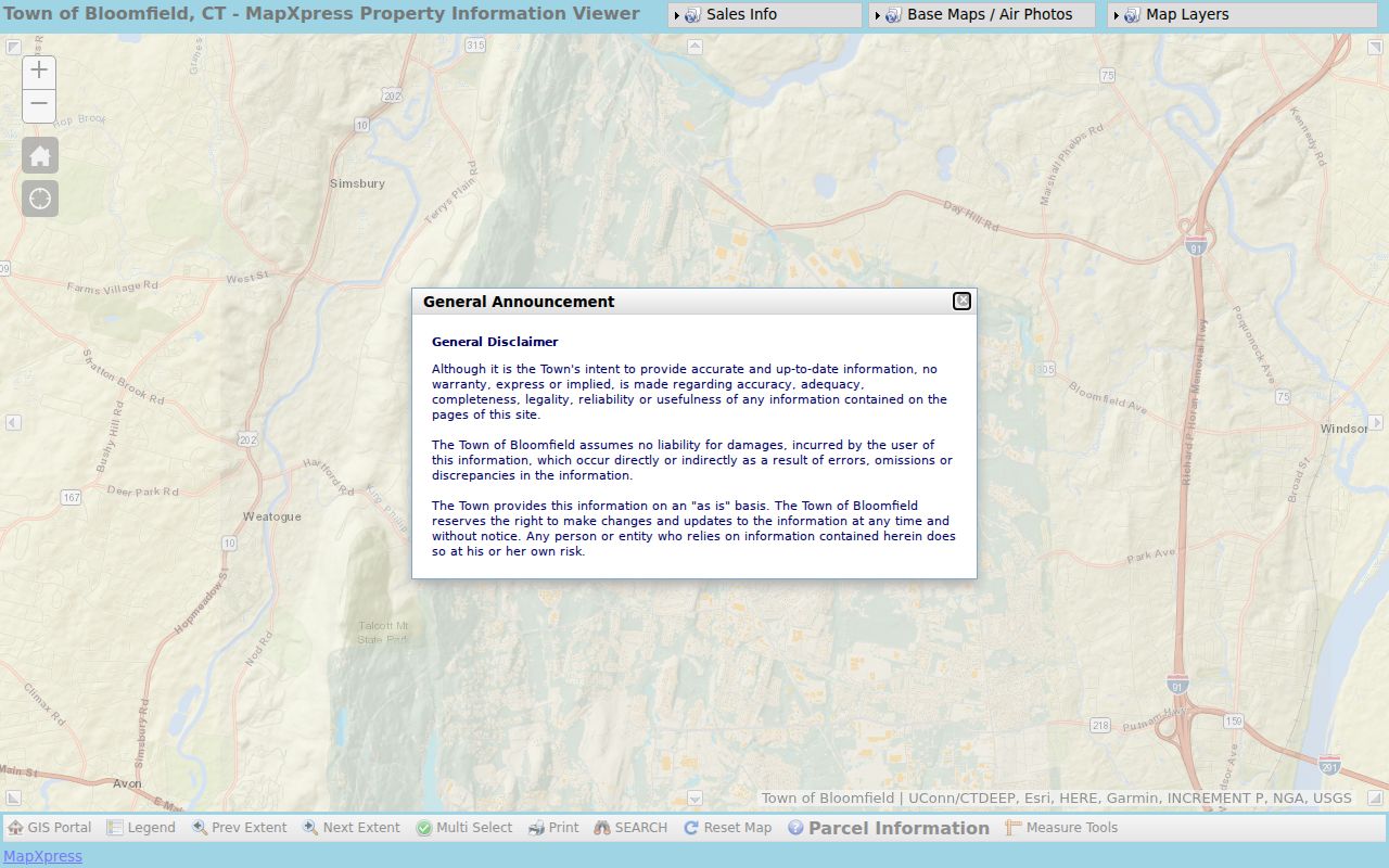
The viewer is useful for seeing where one parcel ends and the next begins, then opening each card separately. Bloomfield warns that parcel lines are approximate and that the map is informational, so a screen boundary is not a survey or a substitute for the Assessor or Engineering office.
The town’s GIS mapping information adds the local role behind the viewer and its geographic data. The official Bloomfield street map helps orient a dated road review, while Bloomfield NewsFlash can supply a dated municipal announcement when a service or road clue needs a time check. A printed map can preserve the date of a visual parcel review, which helps when sales-year colors or parcel data change.
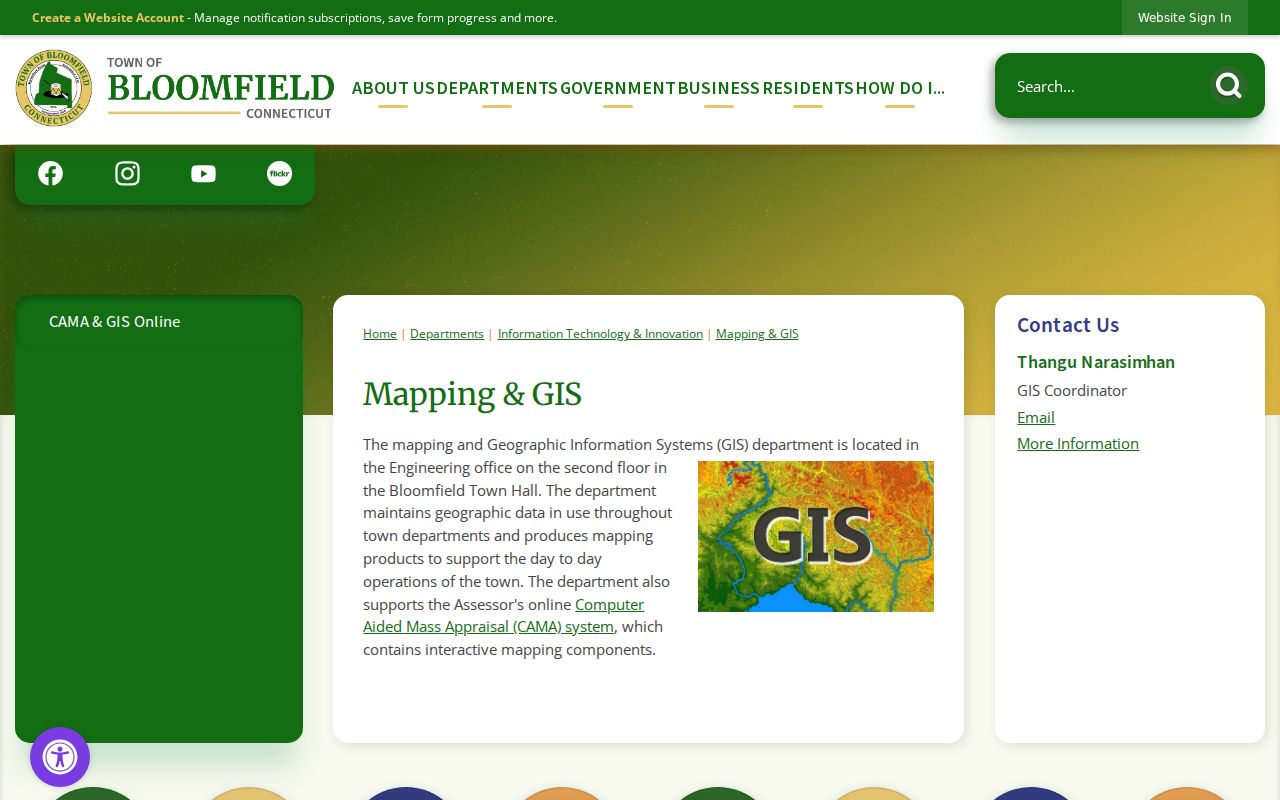
For a block-sized question, select the subject parcel, note each adjacent Unique ID, and repeat the card check. The generated QM_4360 parcel map carries the same informational warning, so keep the words “visual GIS selection” in research notes rather than treating a buffer as legal adjacency.
The 1961 and 1980 Cutoffs
Bloomfield’s online land trail has two important dates. The name and index side reaches April 13, 1961 to the present. Linked recorded images begin August 26, 1980. The assessor portal reports about 7,300 parcels and says property information is updated nightly, while the land index continues to receive new recordings. The split explains why an older result may show a party and book reference without a document image.
Searching the index is free, and the portal provides a watermarked view when an image is available. A recorded document print or download costs $2 per page, while printed search results cost $1.50 per page. Earlier books and images are a Town Clerk, library, archive, or microfilm question. The online cutoff is not evidence that the parcel began in 1961.
Note: A Bloomfield parcel can have current card data even when the older deed image still requires a counter, book, or archive request.
Bloomfield Street Deed Trail
A deed chain along a street is built from names and legal descriptions, not from an address search alone. Search the current owner as grantee, identify the seller or grantor in the latest transfer, and then search that earlier owner as grantee. The legal description, prior book and page, map reference, and parcel ID help keep the chain on the same land when a street label changes or a unit is described differently.
The Bloomfield recorded-land index has party fields for business or last name, first name, party type, second-party fields, document types, and recorded date ranges. Related instruments can explain a gap or a name that appears only once. Useful searches include deeds, quitclaim and warranty deeds, mortgages, releases, assignments, liens, maps, probate certificates, tax-collector deeds, foreclosures, correction deeds, easements, and trade names.
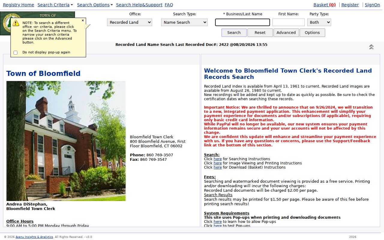
The raw document-type menu contains spelling quirks such as ACREEMENT, ADMENDMENT, CERTICATE, MISCELLANOUS, and SPEICAL W. Those labels are search clues. Try the closest available category and then inspect the result rather than assuming a failed spelling match means no instrument exists.
Old Bloomfield Road Names Matter
Bloomfield’s historical road vocabulary can break a modern street search. The Wintonbury Historical Society’s former street-name source is a useful concordance, but it does not give exact rename years. No official E911 readdressing project year or old-to-new house-number crosswalk was verified, so the names below should be used as search variants rather than as invented dates.
- School Street and Barber Road.
- Burr Road and South Burr Road.
- Gun Mill Road, Wilcox Road, and Hoskins Road.
- Blue Hills Avenue and Granby Turnpike.
- Cottage Grove Road, Gillett Street, Mount St. Benedict Avenue, and Pipe Swamp Road.
- Newberry Road, Terry Plains Road, and Old Windsor Road.
Other concordances connect Wadhams with Sullivan, Loeffler with North Burr, Mountain with West Street, and several older Hartford, Windsor, Tunxis, and turnpike names. Bloomfield’s earlier Wintonbury identity and its 1835 incorporation are useful terms when an older book or local history source names the town differently. When an address stops matching, search the grantor and grantee names, adjoining owners, map and lot, PID, and legal description. A name change can be a bridge between two records, not a reason to discard one.
Note: Exact Bloomfield road-renaming years remain unverified, so a deed or local map should carry more weight than a guessed conversion date.
Bloomfield Address Records and Permits
Permits can add a time layer to a parcel. Bloomfield’s Building and Land Use materials point to a current application system, but public permit address fields were not exposed in the inspected view. The town’s Forms Center is a useful route for locating the public-records request form and related municipal paperwork. For an older addition, demolition, inspection, or alteration, make a narrow request to Building and Land Use or use the Connecticut FOI route for non-exempt material. Describe the address, record type, and date range, and ask for releasable portions if some fields are withheld.
The Bloomfield Building page is the official starting point for the department and its application route.
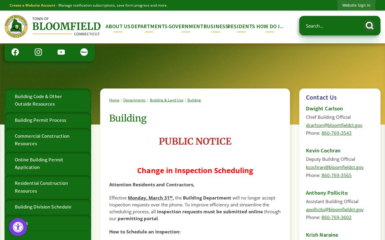
The image reflects a public-facing building source, but it should not be read as a complete address index. Police Records is another defined route. Its request process accepts a location, record type, and time period for releasable reports, daily activity, code-related material, or other listed categories. Send a written request to 785 Park Avenue or call 860-242-5501, and expect exemptions or redactions where the law requires them.
Bloomfield Street Directory for Older Listings
For past occupants, a street directory is a historical lead rather than a current roll. The Bloomfield Public Library genealogy and history resources page lists Ancestry Library Edition, the Hartford Courant archive, researchIT CT, catalogs, and local-history links. Ancestry is available on library computers or library Wi-Fi. The Hartford Courant archive is described as reaching from 1764 to the present, with remote access for Bloomfield library-card holders. Those sources can add obituary, marriage, civic, business, and address context.
The Library of Congress holds Hartford-area telephone books with Bloomfield entries in examples from 1926/27-28, 1954, 1958, 1960/61, 1962/63, 1971/72, 1972/73, and 1974/75. A listing may use “Bimfld,” show a phone exchange, include an occupation or spouse notation, or be absent because a number was unlisted, a household moved, or the page was business-only. OCR can blur columns, so inspect the page image.
The Bloomfield Public Library resource page does not publish an exact printed reverse-directory or criss-cross run. Ask the reference desk for the catalog record and use the 1971/72 Hartford telephone directory scan as a dated comparison. The historical collections themselves have a separate treatment in the Bloomfield city directory research page.
Note: A telephone listing shows a name connected to a number and address at one time, not ownership or a present-day household.
What Bloomfield Street Records Cannot Show
A property card names the person or entity carried on the tax record. It does not list every person who may be at the situs. A voter record answers a registration question and can be suppressed for safety. A telephone directory can be stale or unlisted. Utility customer data, motor-vehicle address data, sealed court material, adoption files, juvenile records, and private organization membership are not shortcuts for a street directory.
The Connecticut voter file is not a public street browser. The official SOTS voter privacy information explains the defined public fields and the Voter Registry Privacy Program. A full statewide file requires a written request and a $300 fee, and protected voters may be absent. Use the individual lookup only for a lawful, specific question, then verify the result with the registrar when accuracy matters.
- Parcel
- A mapped unit of land with its own identifier, card, and legal record. One street address can relate to a condo unit, a larger tract, or more than one parcel.
- Situs address
- The physical location associated with the parcel in the assessor, GIS, building, or fire record. It can differ from the owner’s mailing address.
- Plat
- A recorded map that shows lots, lines, roads, or subdivision relationships. It can help connect a deed description to a street pattern.
- Criss-cross directory
- An address-to-name reference used to work from a house or street toward a listed household. The exact Bloomfield run remains a library catalog question.
Lawful use. Bloomfield street and address records are for personal, lawful research such as house history, genealogy, civic review, and consumer-safety checks. Do not use a name or address to stalk, harass, intimidate, or harm another person.
When the question shifts from a whole road to one person, the Bloomfield resident lookup uses a separate identity-checking workflow. Keep notes about the source, date, role, and limits of every result, and contact the custodian instead of filling a gap with an assumption.