
Bloomfield ZIP Coverage
Only one mailing ZIP is verified for Bloomfield in the official USPS and town sources reviewed. The Bloomfield Post Office serves the town mailing city at 40 Jerome Avenue, and its listing uses the extended form 06002-9998. Nearby postal locations can appear in a search because the Hartford and West Hartford service areas sit close to Bloomfield. That does not make their ZIPs Bloomfield ZIPs. Keep the comparison rows below separate from the verified town row.
| ZIP | Areas Covered | Post Office | Notes |
|---|---|---|---|
| 06002 | Bloomfield mailing city | Bloomfield Post Office, 40 Jerome Avenue | Verified Bloomfield ZIP; USPS listing shows 06002-9998 |
| 06112 | Blue Hills Station and Hartford postal area | USPS nearby location, 433 Woodland Street, Hartford | Comparison location, not a verified Bloomfield ZIP |
| 06117 | West Hartford and Bishops Corner area | USPS nearby-location results | Comparison location, not a verified Bloomfield ZIP |
The table is a coverage guide, not a delivery-boundary map. A specific house number can settle a postal question better than a town name in a form. For a current result, use the USPS mode that starts with an address and save the returned city and ZIP with the date of the check.
The Bloomfield Post Office listing is the clearest local source for the verified mailing location, phone, and retail schedule.
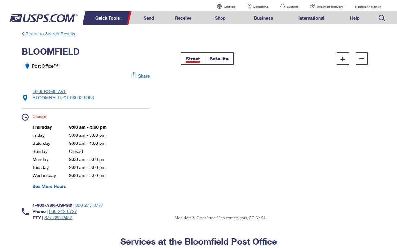
The post-office record anchors 06002 to a local retail counter, while the extended ZIP+4 suffix belongs to delivery routing and should not be read as a separate town ZIP.
Bloomfield ZIP Search Steps
Finding a person or parcel within one ZIP takes more than typing a number into every local database. Bloomfield’s assessor search is built around a name, house number and street, or Unique ID. The GIS viewer has no visible ZIP filter. The statewide voter lookup uses town, name, and date-of-birth fields. ZIP is a useful cross-check, but it is not the common key across the town’s records.
- Run USPS By Address with the street, city, and state. Leave the ZIP field open when the question is which code the address receives.
- Write down the standardized city label and ZIP, then keep the result tied to the exact street number. Do not turn a nearby post office into a Bloomfield assumption.
- For a property clue, search the Bloomfield Assessor MapXpress property search by owner name, house number and street, or Unique ID. The screen does not expose a ZIP-wide mode.
- For a court property matter, use the state property-address form and treat its result as a case index, not a resident directory.
- For history, compare the postal result with a dated telephone book, newspaper, cemetery record, or library reference source, since older entries may lack a modern ZIP.
Once a ZIP narrows the question to a street, the address-keyed chain belongs in the Bloomfield street directory: parcel, owner, legal description, and the sources that may explain a gap.
USPS Fields for ZIP Checks
The USPS lookup has three useful directions: By Address returns a standardized delivery result, By City & State lists postal combinations, and Cities by ZIP reverses the question. By Address is the right first choice when a Bloomfield edge or a nearby Hartford label is in doubt. Its warning is important: standardization confirms how USPS handles the address, not whether a particular person or business is located there.
| USPS field | Required | What to enter |
|---|---|---|
| Company | Optional | Business or organization name, when relevant |
| Street Address | Required | Street number and street name |
| Apt / Suite / Other | Optional | Unit, suite, floor, or other delivery detail |
| City | Required | Bloomfield or the city label supplied for the address |
| State | Required | Choose Connecticut from the state control |
| ZIP | Optional | Use it to test or refine an expected five-digit code |
| Find | Action | Return the standardized delivery result |
Company is optional even when a business name is part of the clue. An apartment line can change the delivery result without changing the legal parcel. Save the result as postal evidence, then move to the record keeper whose question matches the purpose.
Bloomfield Address Roles
One Bloomfield location can carry several addresses at once. The assessor and GIS usually emphasize the physical parcel. A tax bill may use a mailing destination somewhere else. A deed relies on a legal description, and a voter record uses the voter residence supplied for registration. A historical directory may show a directory address that predates today’s street name or number. The postal directory becomes clearer when each role stays in its own lane.
- Postal code
- A five-digit USPS delivery area used to sort mail. It is not a legal municipal boundary.
- ZIP+4
- The four extra digits narrow delivery within the five-digit route. It is not a new Bloomfield ZIP.
- PO-box ZIP
- A ZIP assigned for post-office boxes or a limited postal function, which may not describe a street parcel.
- Unique ZIP
- A code assigned to one institution or organization when USPS designates a distinct delivery stream.
- Carrier route
- A delivery path inside a ZIP, useful to USPS operations but not a public household list.
- Situs address
- The physical location of the parcel, used by the assessor, GIS, building, and fire systems.
- Mailing address
- The destination for tax or owner correspondence, which may be out of town or shared by several parcels.
- Legal description
- The deed or map language that identifies land by lot, map, bounds, or prior recorded reference.
These distinctions matter when a name search returns an owner mailing address but the goal is to understand the parcel, or when a directory address looks close to a modern road but does not match it exactly.
Note: A postal match can standardize delivery while leaving ownership, occupancy, and the legal parcel as separate questions.
Bloomfield ZIP Boundaries and Town Lines
ZIP geography and legal geography overlap without matching. Bloomfield pages consistently use 06002, yet a postal city label does not prove that every address carrying it sits inside the legal Town of Bloomfield. The reverse is also possible: a location near a town edge may be served through a neighboring postal area. When a record matters, compare the USPS address result with the parcel map and the town custodian. Do not use a ZIP map as a substitute for a survey, deed, or municipal boundary record.
The Census ZCTA guidance explains the statistical distinction. A ZCTA is a generalized area built for Census data. Postal codes are USPS delivery routes and points. ZCTAs can be noncontiguous, unique, or PO-box based, and neither kind of postal geography is a legal town line.
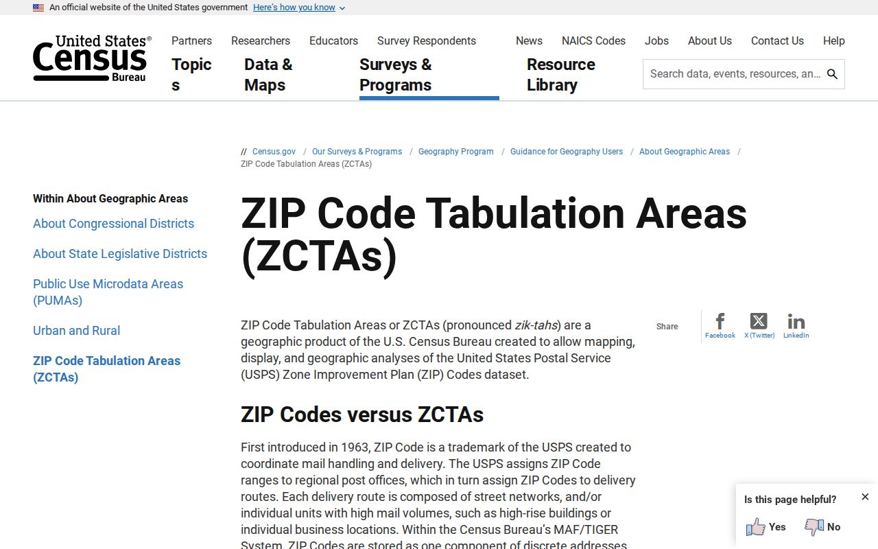
The Census view is helpful for population statistics, but a person or parcel search still needs the actual delivery result and the local record’s own address key.
Boundary check: Use USPS By Address for the street number, MapXpress or GIS for the parcel, and the Town Clerk or other custodian for the legal record. A mailing city is evidence of delivery, not proof of municipal location.
Nearby ZIP Comparisons
Blue Hills and Bishops Corner are useful comparison points because they sit near Bloomfield in the Hartford region. They should stay labeled as comparisons. The research did not verify a Bloomfield address served by 06112 or 06117, and it did not locate a street-by-street USPS delivery-boundary file, a ZIP split year, or a unique institutional ZIP for Bloomfield.
Verified Bloomfield. 06002 is the only Bloomfield mailing ZIP confirmed in the official sources reviewed.
Nearby comparison. 06112 points to the Hartford Blue Hills postal area, while 06117 points to West Hartford and Bishops Corner results. Neither should be labeled a Bloomfield ZIP without a USPS address result.
This gap is a reason to use an address-first workflow. It is not a reason to fill the table with guesses. If a database or old directory assigns a different code, preserve the source date and check whether the entry uses a postal city, a former road name, a PO box, or a regional listing.
Bloomfield ZIP Records Without a ZIP Filter
Several official systems touch ZIP information, but they answer different questions. The assessor and GIS are current parcel tools. Civil inquiry can accept a ZIP as one part of a property-address case search. CTBigList can narrow an unclaimed-property name search by ZIP. The voter lookup does not show a ZIP field. This is the numbers-and-cutoffs lesson behind a careful postal directory: a current local map can be free and useful, while a statewide file may require a written request, and a deed image can cost more than the index search.
The Connecticut civil property-address search supplies a ZIP-capable screen, and the captured form is shown below as a property-case tool.
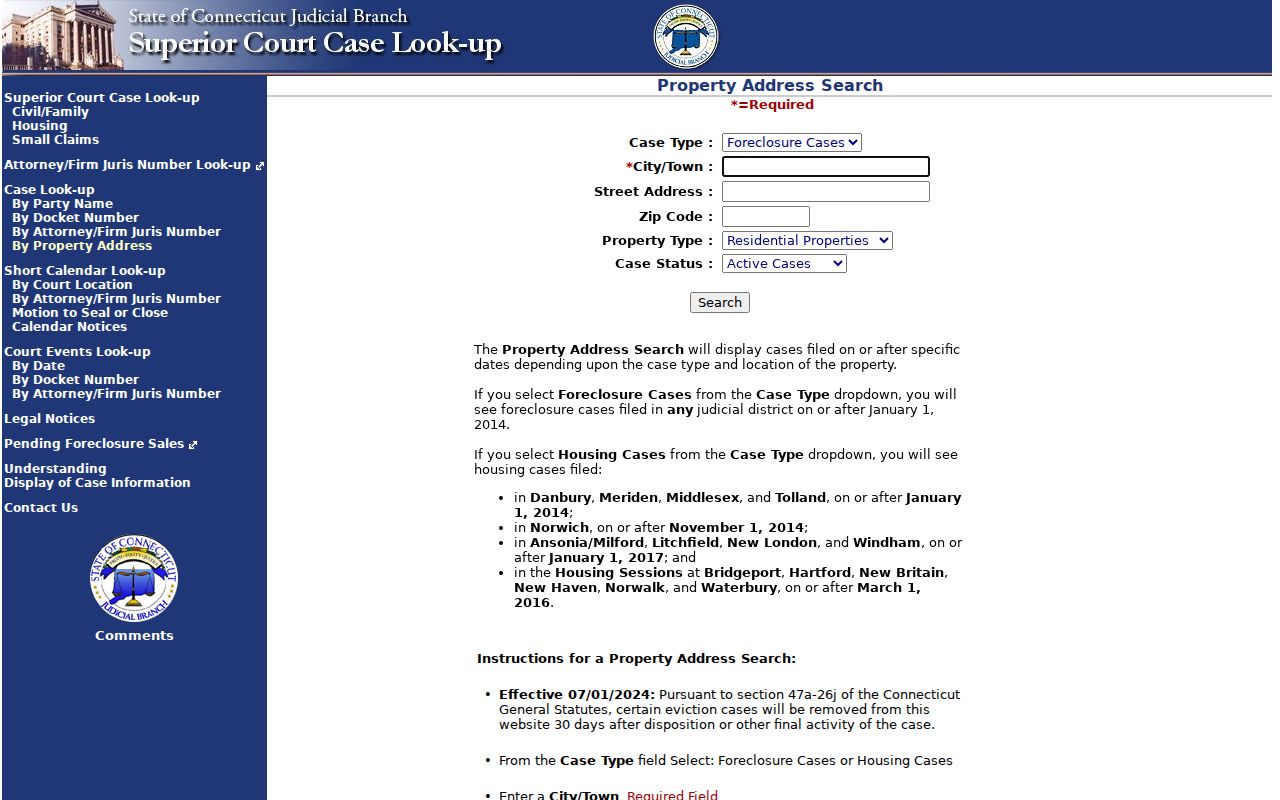
The civil form can narrow a public case index by property address, but its result is about a case and property record, not the people who receive mail there.
| Portal | ZIP field or mode | What the result means |
|---|---|---|
| MapXpress property search | No visible ZIP field; name, house number and street, or Unique ID | Parcel and assessment clue |
| Bloomfield GIS viewer | No visible ZIP filter | Parcel, layer, aerial, and adjacent-parcel context |
| Civil property-address search | Five-digit ZIP optional; case type for foreclosure or other listed property matters; City/Town; Street; Property Type Residential/Commercial/All; Case Status Active/Disposed/All | Property case index, not a resident list |
| Connecticut voter lookup | No ZIP field observed; Town, Last Name, First Name, Date of Birth | One registration and polling confirmation when visible |
| CTBigList | Optional ZIP, city, last or business name, first name, or Property ID | Unclaimed-property lead; claim proof is separate |
CTBigList is linked from the State Treasurer route and is free to search. The CTBigList claim search can show an owner name, city, ZIP, property ID, holder, report year, and an amount band, but it does not prove current residence. A claim still requires identity and ownership proof.
Current voter technology is another reason to date a result. Connecticut has been testing a GIS-based TotalVote upgrade planned for December 2026, so a voter file or district assignment should be checked through the live state route rather than treated as permanent.
Older Roads and ZIP Clues
Historical Bloomfield address work often fails because the road name changed, not because the person was absent. The Wintonbury former-name list connects current roads to older terms. Exact rename years were not located, so each variant should be treated as a search lead rather than a dated fact. Regional telephone books can also use “Bimfld” or omit a modern ZIP altogether.
- School Street and Barber Road are linked in the former-name list.
- Burr Road and South Burr Road can describe the same road history.
- Blue Hills Avenue and Granby Turnpike overlap in older road references.
- Cottage Grove Road, Gillett Street, Mount St. Benedict Avenue, and Pipe Swamp Road form another useful variant set.
- Newberry Road, Terry Plains Road, and Old Windsor Road can matter when an old directory or deed uses a prior name.
The Bloomfield Public Library genealogy and history resources page provides a bridge to regional telephone books, newspapers, Ancestry Library Edition, researchIT CT, and reference help. Search the scanned image, not only its OCR or a modern ZIP filter.
Note: Former road names are documented, but the public source does not supply a complete rename-year table for Bloomfield.
Bloomfield ZIP Access Paths
A failed online search does not end the research. USPS can answer delivery questions through its web modes, the Bloomfield counter, or the post-office phone. Town staff can explain which local record uses a postal address and which uses a parcel or legal description. A written request can also narrow a non-exempt municipal record to an address and date range.
- USPS: The Bloomfield Post Office listing gives 40 Jerome Avenue, 860-242-0727, and retail hours Monday through Friday 9 to 5 and Saturday 9 to 1. Use the online lookup for a specific address.
- Assessor and GIS: MapXpress property search and the interactive viewer are free; the Assessor is 860-769-3530 and Engineering/GIS is 860-769-3524.
- Town Clerk: Land and local record questions can go to 860-769-3507, with counter, phone, mail, and written-request routes.
- History: BPL can help with directories and newspapers, while the Connecticut State Library and Archives can bridge older maps, court indexes, and genealogy sources.
- FOI: Connecticut’s Freedom of Information Act, Chapter 14, provides a written route for non-exempt municipal records. Target the custodian, describe the address and date range, and ask for electronic copies when useful.
The Bloomfield Town Clerk is the local custodian for land and vital records rather than a Hartford County recorder. For a record request, CGS §§1-210, 1-212, and 1-206 describe access, municipal copy caps of 50 cents per page, and written-denial or appeal timing. A denial is generally due within four business days, with an FOI appeal generally due within 30 days. Exemptions still apply.
What a Bloomfield ZIP Can Prove
A ZIP result can show how USPS standardizes delivery for a particular address at a particular time. It can help sort a CTBigList search, narrow a civil property inquiry, or explain why a regional telephone entry appears under a nearby city. It cannot prove that an owner occupies the parcel, that every household member uses the address, or that a missing name never lived there.
Use dates, source roles, and matching details together. A parcel Unique ID, a legal book and page, a voter registration, and a phone-directory entry are different kinds of evidence. A same-name match is only a lead until the address, time period, and record custodian agree. This is the practical standard for a Bloomfield ZIP code directory used for genealogy, family research, civic questions, property curiosity, or personal safety.
Safe use. Keep sensitive identifiers out of notes, verify a result with the office that holds the record, and never use a postal search to stalk, harass, intimidate, or harm a person.